


Garmin Iran Topographic Map
Description
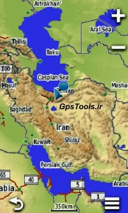
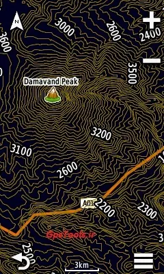
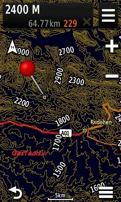
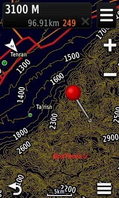
Garmin Iran Topographic Map Product Description : 100% Iran cover The distance of the sub-curves is 20 meters. The distance between the main curves is 100 meters. With Zip file installation guide Applicable to Garmin GPSs , including: eTrex 20 - 30 - 20x - 30x - touch 25 - touch35 GpsMap 62s - 72h - 64s - 64 - 66s Oregon 550 - 650 - 750 Montana 800 - 850 Montra Automotive and sports equipment including: nuvi - desel Cycling devices including: Edge Garmin watches including: Fenix5x And . . . Models that do not support this product: Series devices: + Inreach explorer and the like eTrex vista - GpsMap 76csx And . . . How to get the product: Once selected and paid online, the download link will be displayed. Call or send telegram support if needed. ID: Gps_Tools

، پالیترا")


")
")

